
Atlases and maps
The Atlases and Maps section provides guidance on various topics (historical, topographical, thematic) through a selection of diverse items: atlases, globes, planispheres in different projections, unusual maps, plans, and maps of cities around the world.
This section, located in the History compartment, is designed to meet the needs of all disciplines: geography and urban planning, of course (general atlases), but also history (old maps), geopolitics, science (geology, sky), economics, etc. In addition, this space offers a selection of cartographic documents ranging from globes to planispheres in various projections, historical and thematic flat (unfolded) maps in a dedicated cabinet, and the traditional topographic series of folded maps of France, cities, and countries around the world.
Folded maps: cities, countries, and regions of the world. Topographic France
The series of topographic maps produced by the National Geographic Institute (notably its flagship “blue series” at a scale of 1:25,000) are regularly updated and supplemented for foreign countries by National Geographic or Freytag. However, certain IGN series (such as the “orange” series) and the BRGM geological maps have been removed from the Bpi shelves and transferred to other libraries.
Flat maps, planispheres, globe
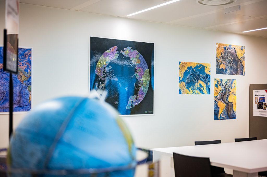 ©fredatlanespace
Digital tools have displaced the centrality of printed media. Today, almost everyone can be geolocated in order to use the big data maps managed by various public and private operators. But do we really know how to find our way around better?
Geopolitical, energy, and climate emergencies require us to have a basic understanding of distances, terrain, relief, density, and representations of space, territories, and cities. All relevant digital applications (Iphigénie, Geoportail, Google Earth, Open Street, Baidu) integrate and process these concepts derived from “analog” artifacts. But unless you have large digital tables at your disposal, it is difficult, if not impossible, to perceive synthetically on screen the relative weight of certain spaces in relation to others, such as the importance of the Arctic, Crimea, or the Mediterranean. As shown by the persistence of the Mercator projection (even among Google’s Chinese competitor Baidu), smartphone mapping is richer in data than in representations. Its relevance will be measured based on analog experience and reconstruction.
This is why, alongside a large globe, you can consult numerous flat maps without having to unfold them: planispheres in different projections (Mercator, Peters, Dymaxion), ancient maps and relief maps, thematic maps (history, geology, vegetation, watersheds, population).
Atlas

This range of documentary objects complements our everyday experience of mobile digital tools.
The proximity of a large collection of varied atlases enriches this offering through:
- general and regional atlases (ultimately, in all major languages);
- atlases of ancient maps;
- maritime, forestry, and geological atlases;
- thematic and cultural atlases; unusual atlases: prejudices, imaginations, etc.